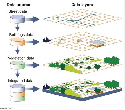
GIS is essentially the laying of information / data onto a base map. It allows large amounts of information to be seen by layering one set of information on to another. The base information is a map of the area being studied.
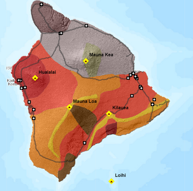
This map shows the layer potential lava flow data onto a base map of an area of Hawaii in order to see which houses are more likely to be affected by a volcanic eruption should it occur. Today we are going to explore GIS to identify how they can be useful to solve spatial problems SC:
We will use two scenarios to explore how GIS work to solve problems Christchurch over time Hazards in Hawaii
0 Comments
Leave a Reply. |
Angela SeybThis page will provide you with an overview of the current work in GEO111. Categories
All
|
 RSS Feed
