|
Climate graphs combine two pieces of information; rainfall and temperature onto the one graph. The bars represent the rainfall in mm and the line represents the temperature in degrees Celsius. The x-axis always shows the months of the year, but there are two y-axes. When interpreting climate graphs we want to identify
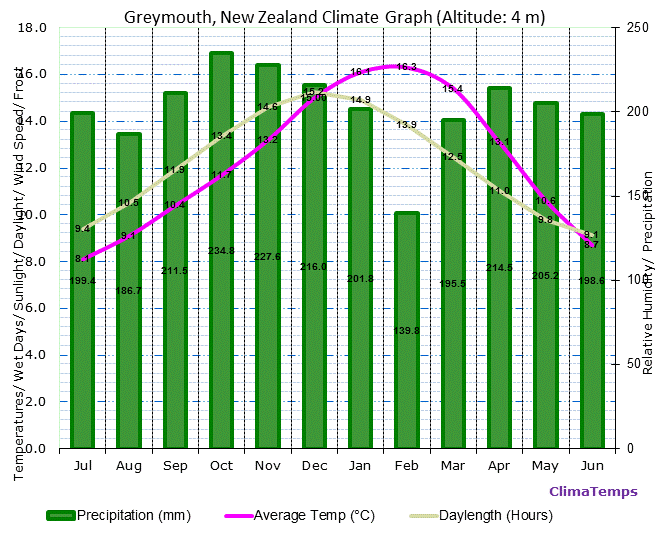 Graph sourced from: http://www.greymouth.climatemps.com/
Your task is to
A more detailed review of the climate of the West Coast can be found in this report produced by NIWA.
0 Comments
|
Angela SeybThis page will provide you with an overview of the current work in GEO111. Categories
All
|
 RSS Feed
